Get a flat 20% discount on all plans!
Practical Seismic Processing Expertise For Land And Marine Projects, Focused On Real Operational Performance
Koktan Seismic delivers specialized seismic acquisition & processing software development and seismic data processing consultancy services for land and marine projects. With decades of hands-on industry experience, we focus on acquisition geometry QC, seismic processing workflows, and custom processing tools designed to solve real operational challenges.
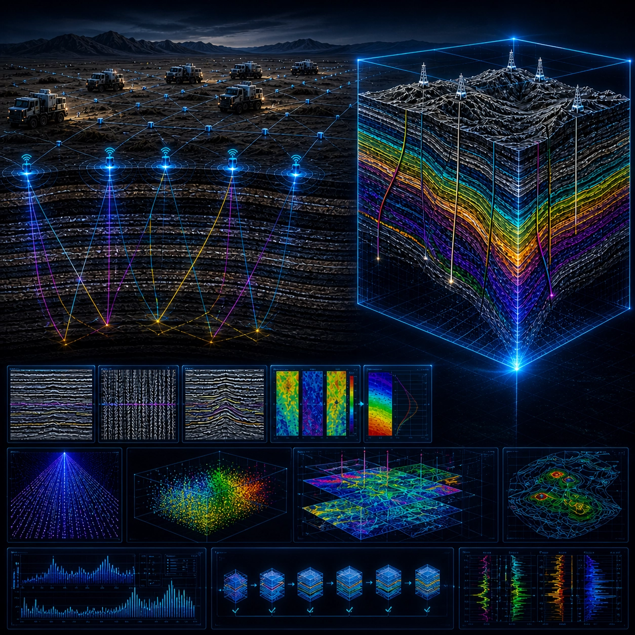
Built on 30+ Years of Seismic Expertise
With over 30 years of experience in petroleum exploration and more than 19 years of hands-on expertise in advanced 2D and 3D seismic data processing, Müfit Er Köktan delivers deep technical knowledge and field-proven insight.
As the founder of Koktan Seismic Consulting, he has led international projects, managed complex processing workflows, and contributed to seismic operations across regions including West Africa and the Eastern Black Sea.
His expertise spans the full seismic processing workflow, with a strong focus on data quality, software usability, and efficient, practical solutions.
JeoPulse 2D Geometry QC Tool
Precision in 2D Geometry
Modern software package to support land seismic acquisition geometry building, verification, and QC. Designed for field crews and geophysicists.
Core Architecture
- Developed in Python 3 using high-performance tksheet library.
- Matplotlib integration for interactive 2D coordinate plots.
- Scalable up to 25,000 rows and 6,000 channels per shot.
- Optimized for fast UI performance via FNV-1a hashing.
Advanced QC Algorithms
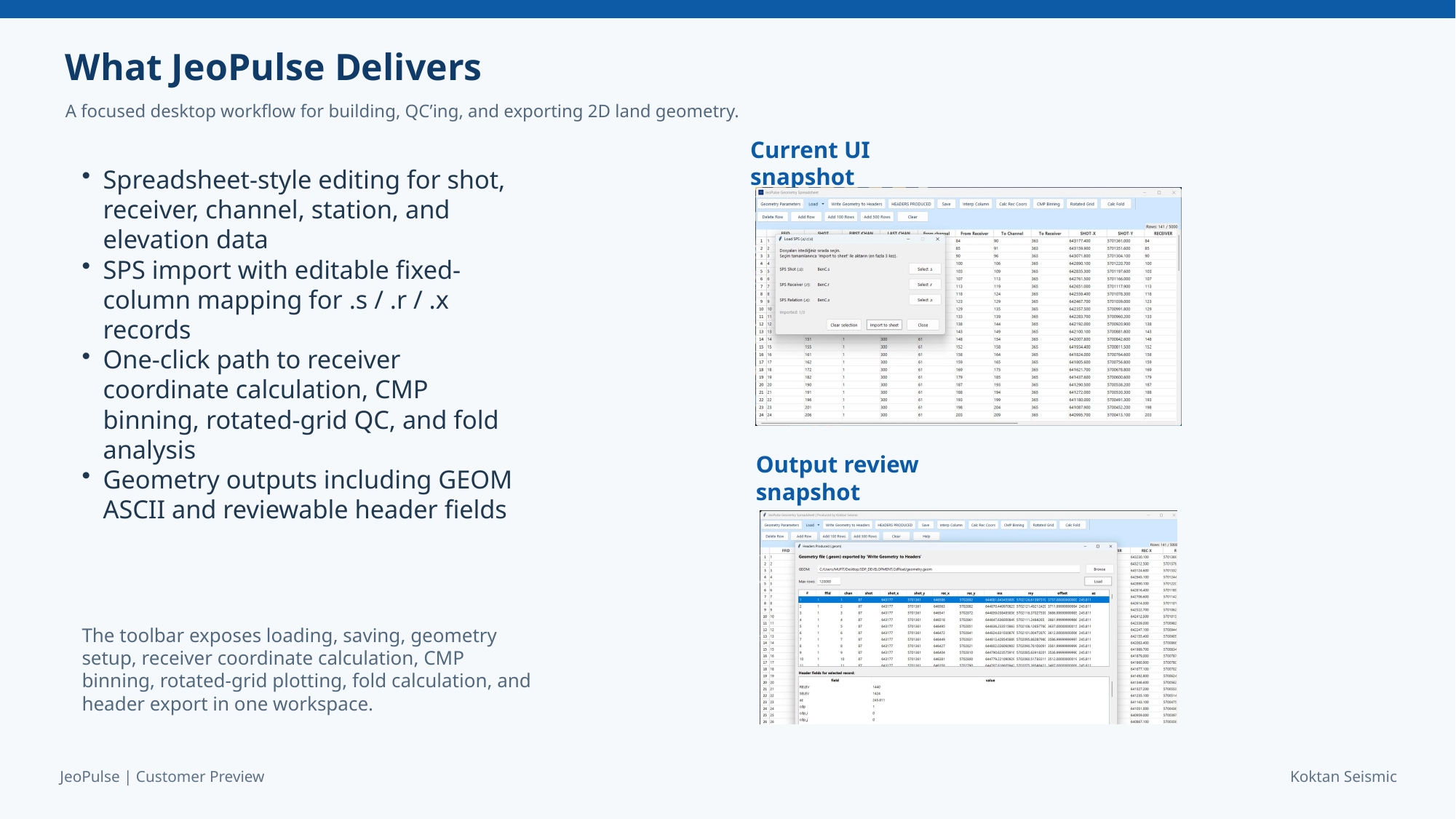
This module provides advanced seismic geometry QC tools with SPS support, precise coordinate calculation, CMP binning, fold analysis, and built-in data filtering for reliable results.
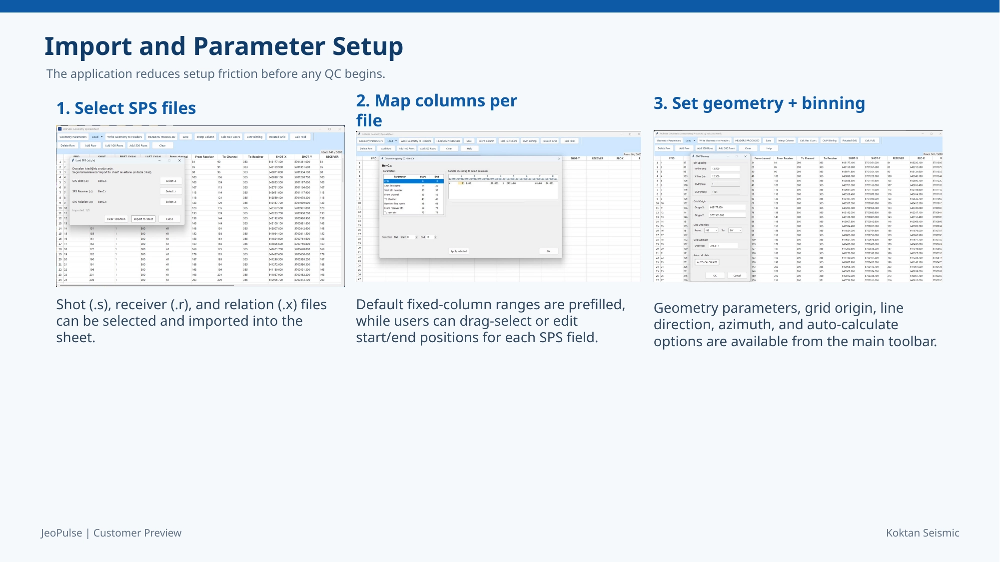
- SPS Support: Import Standard .s, .r, and .x files.
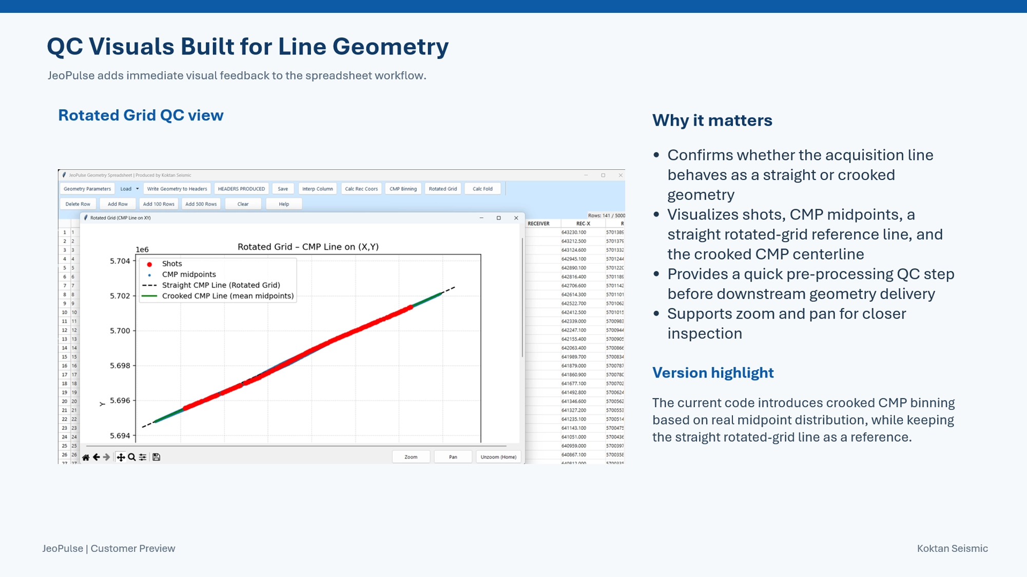
- Crooked CMP Binning: Calculates non-linear centerlines based on real midpoint distribution.
- Coordinate Calculation: Auto-calculates Rec X/Y using azimuth and station intervals.
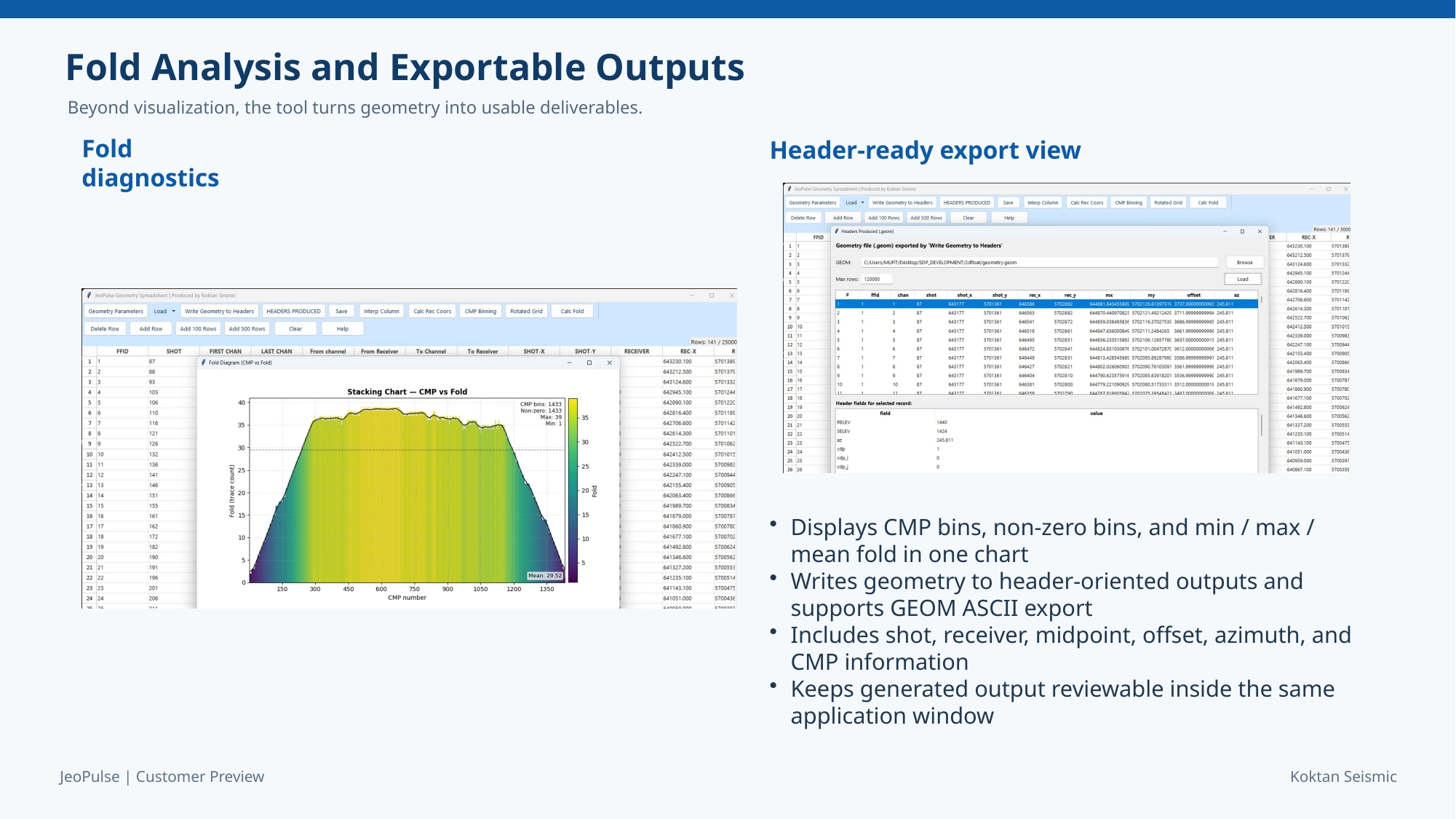
- Fold Analysis: Detailed Stacking Charts with mean, max, and non-zero bin counts.
- Killed Row Management: Exclude erroneous data from calculations.
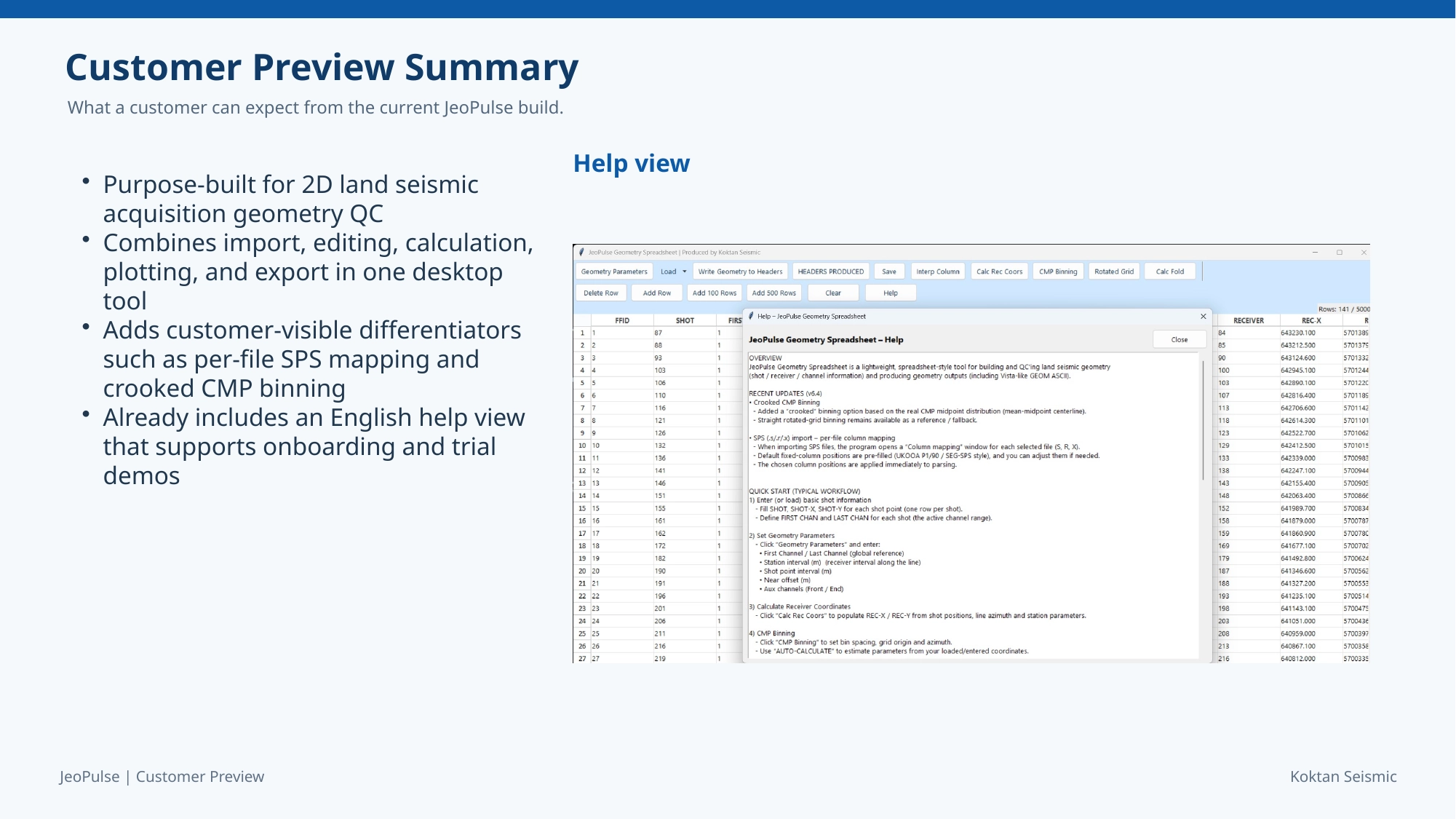
JeoPulse 2D Geometry QC Tool - Customer Preview
JeoPulse 3D Geometry QC Tool
Where Geometry Becomes Certainty
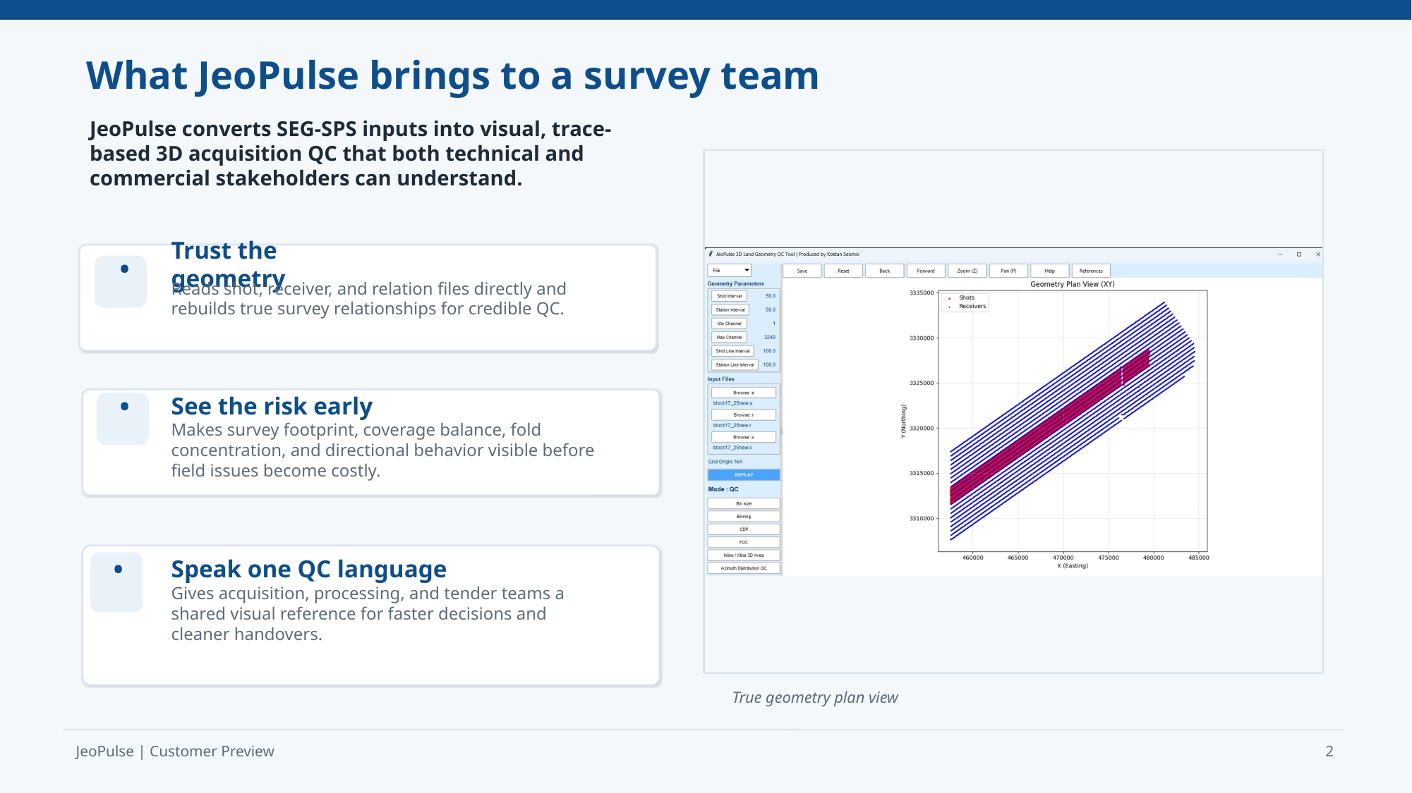
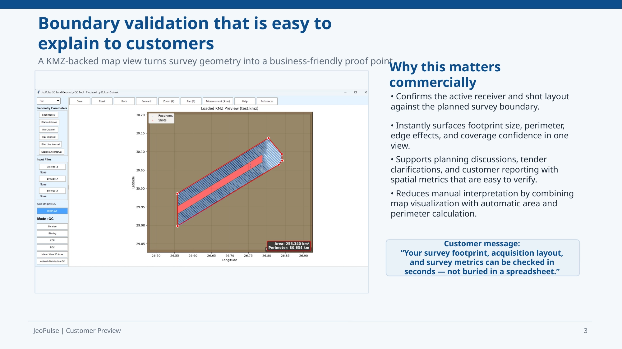
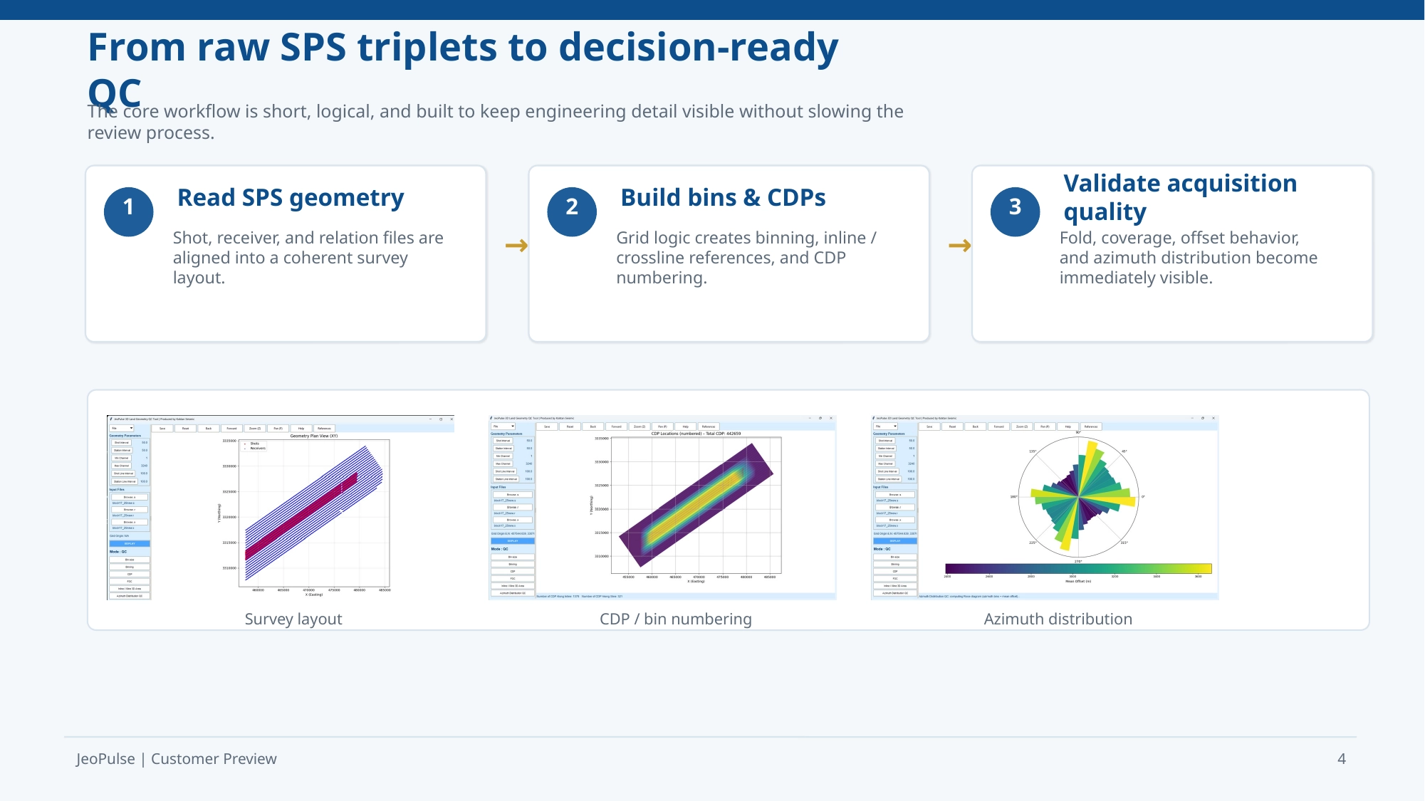
Directly reads SEG-SPS files and performs calculations from real shot-receiver relationships. Ideal for survey validation and tender preparation.
Technical Architecture
- Python 3 based with NumPy-powered high-speed rotations.
- Supports datasets exceeding 300,000 points via visual downsampling.
- Full compatibility with SEG-SPS (Shot, Receiver, Relation).
- GUI-based Column Spec Editor for non-standard file parsing.
Advanced QC Algorithms
These features automate the orientation, coverage analysis, and quality control of seismic survey data, enabling faster, more consistent, and more reliable geophysical interpretation.
- Survey Rotation: Auto-detects survey direction via Principal Component Analysis (PCA).
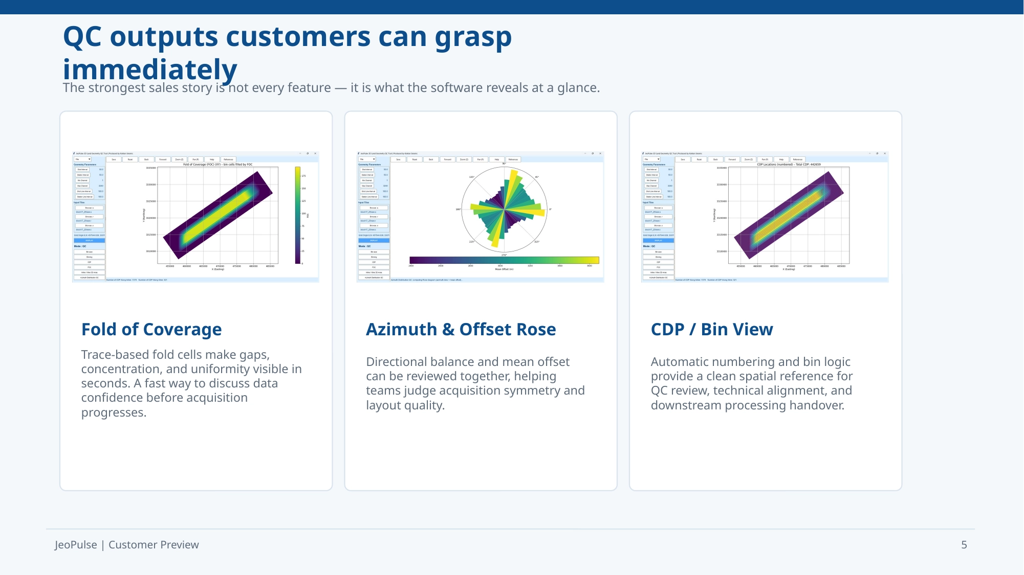
- Fold of Coverage (FOC): Visualizes trace counts using color-filled bin polygons.
- Azimuth & Offset QC: Polar Rose Diagrams showing density and Mean Offset.
- CDP Layout: Automatic corner labeling for Inline and Xline.
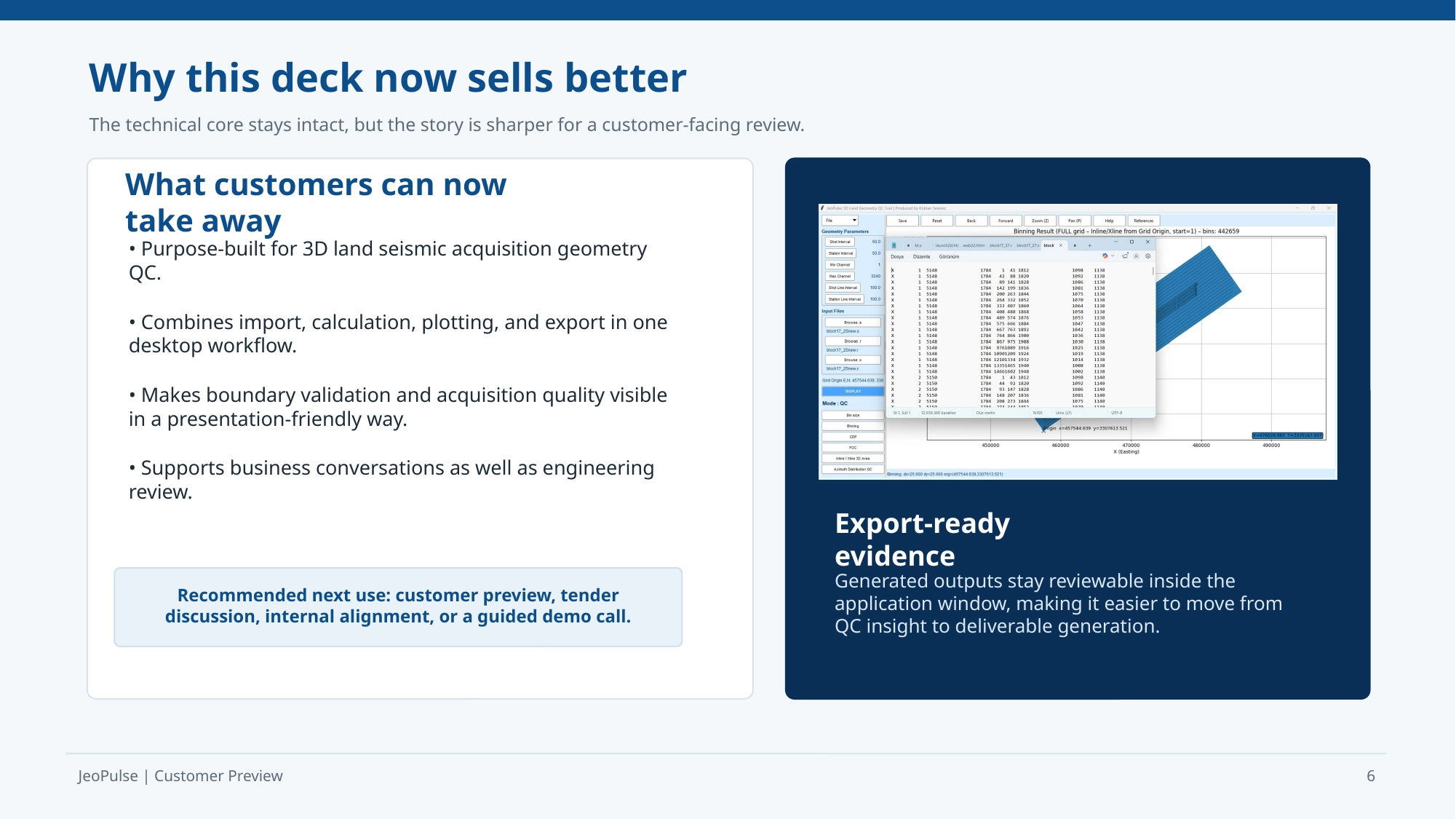
- SPS Output: Generate and export full survey standard SPS triplets.
JeoPulse 3D Geometry QC Tool - Customer Preview
Frequently Asked Questions (FAQ)
How is the software delivered after purchase?
After successful payment, all software is delivered as Windows executable (.exe) applications. The download is provided securely via WeTransfer, allowing fast and reliable access. Each package is prepared in a ready-to-use format for Windows systems, and no complex installation process is required.
How does the licensing system work?
Licensing is machine-specific and tied to a single computer. Each license includes a dedicated license file that must be placed in the same folder as the executable in order for the software to run. Licenses are issued strictly for single-user use and cannot be transferred between multiple machines.
What license durations are available and what happens when it expires?
Licenses are offered on flexible terms, including monthly, 6-month, and 1-year rental options. Each license is valid only for the selected period. Once the license expires, continued access to the software requires renewal. If the license is not renewed, the software will no longer function on the licensed machine.
Do I receive updates and technical support during the license period?
Yes. All software updates released during the active license period are included at no additional cost. These updates may include performance improvements, bug fixes, and new features. In addition, remote installation and activation support is provided via TeamViewer to ensure proper setup and smooth operation of the software.
What is your refund and cancellation policy?
Due to the nature of digital software products, all sales are final. Once the software has been purchased and delivered for download, no refunds, cancellations, or exchanges can be provided. By completing a purchase, you acknowledge and agree to this policy. We strongly recommend contacting our team before purchase if you have any questions or require clarification about functionality, licensing, or compatibility.
This section provides clear answers to the most common questions about our software, licensing system, delivery process, and usage conditions. Please review the information below to better understand how our solutions are provided and supported.
Have questions? We are here to help you.
Have a question, need more information, or want to discuss a custom solution? Our team is ready to assist you with technical details, software licensing, or seismic consultancy services. Fill out the form below and we will get back to you as soon as possible.